Akli Fm
Type Locality and Naming
OUTCROP: Type section is in Quarry section at Hathi Singh Ki Dhani. [Original Publication: Siddiqui, H.N. and Bahl. D.P., 1965: Geology of the bentonite deposits of Barmer dist. Rajasthan: GSI Mem. No.96, pp. 1-96]. Reference section: Akli, Thumbli, Giral and Sheo areas and in tube well at Bhadka and Bhimda villages
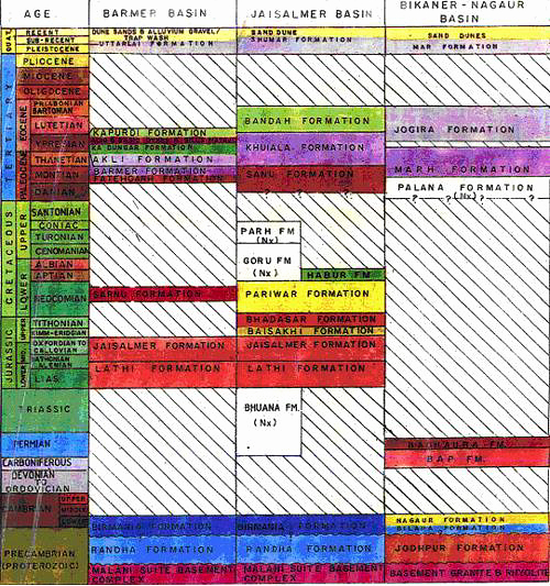
Synonyms: La-Touche (1902) was first to map the bentonite deposits in Barmer District and included it in Barmer Sandstone. Bhola (1946) identified the clay as bentonite but Siddiquie and Bahl (1965) separated this clay sequence from Barmer Formation and placed it above Kapurdi Formation. Subsequently, Dasgupta et al (1973) restudied this sequence and retained the nomenclature but revised its stratigraphic position. They also subdivide the lithounit into two members: lower Thumbli Member and upper Akli Member. This nomenclature of Dasgupta et al (1973) was followed by subsequent workers (Mishra et al., 1993).
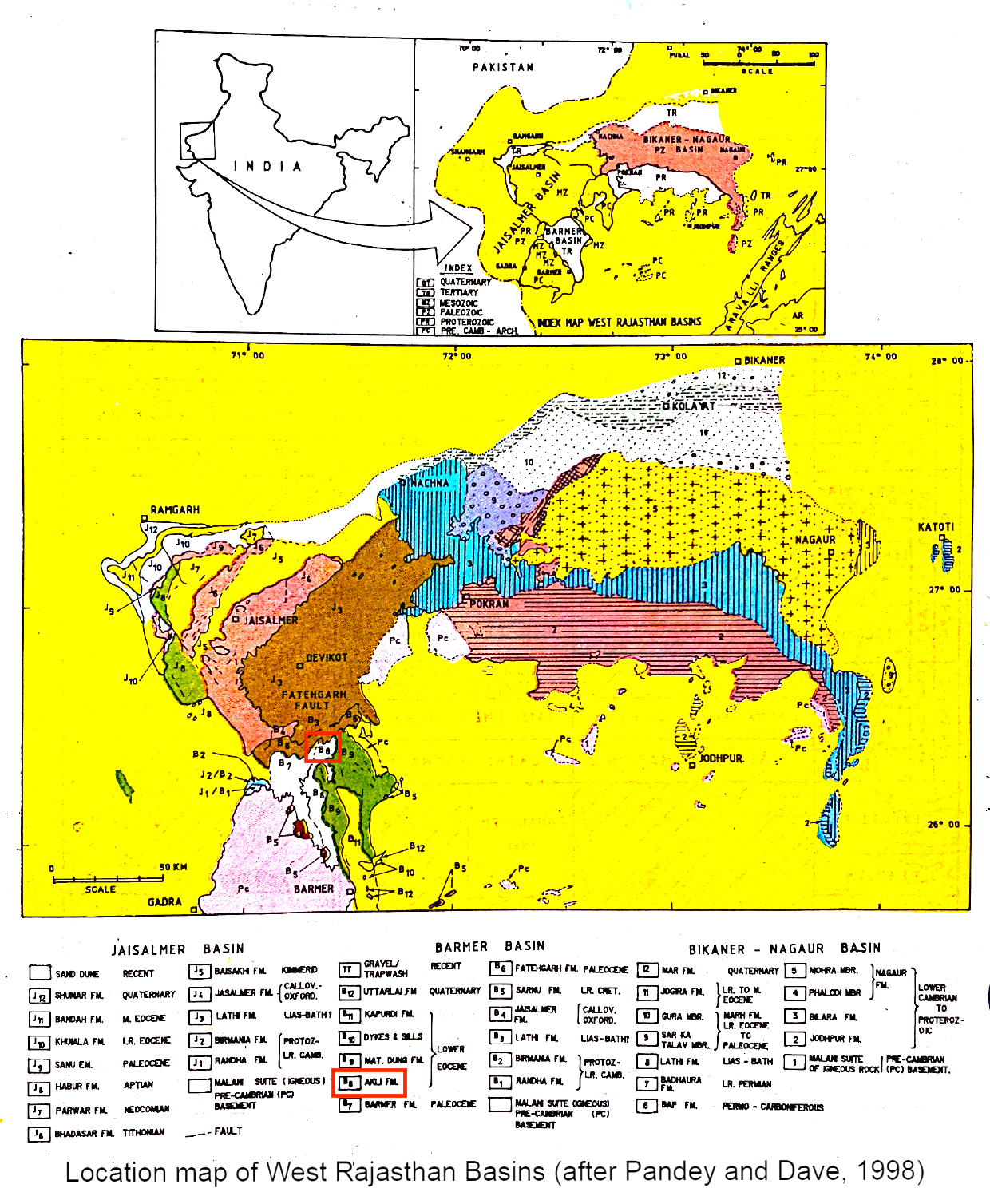
[Figure 1: Location map of West Rajasthan Basins (after Pandey and Dave, 1998)]
Lithology and Thickness
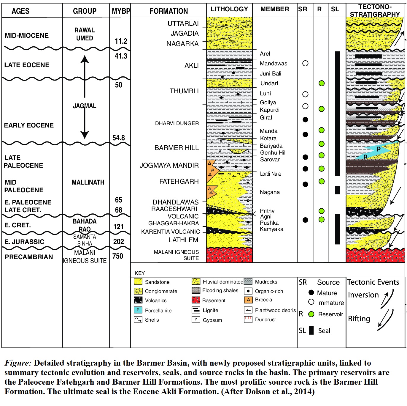
Clayey sandstone. This formation is divided into two members. The Thumbli Member comprises essentially sandstone with lignite and bituminous layers with occasional gypsum and marl beds. The Akli member is characterized by the alternation of sandstone, sandy clay and bentonite layers. At places gypsum-rich and marly beds are present. It is further divided into Arel Member, Mandawas Member, Juni Bali Member in subsurface. Maximum thickness of this formation is about 280m.
[Figure 2: Detailed stratigraphy in the Barmer Basin, with newly proposed stratigraphic units, linked to summary tectonic evolution and reservoirs, seals and source rocks in the basin. The primary reservoirs are the Paleocene Fatehgarh Fm and Barmer Hill Fm. The most prolific source rock is the Barmer Hill Fm. The ultimate seal is the Eocene Akli Fm (Dolson et al., 2015)]
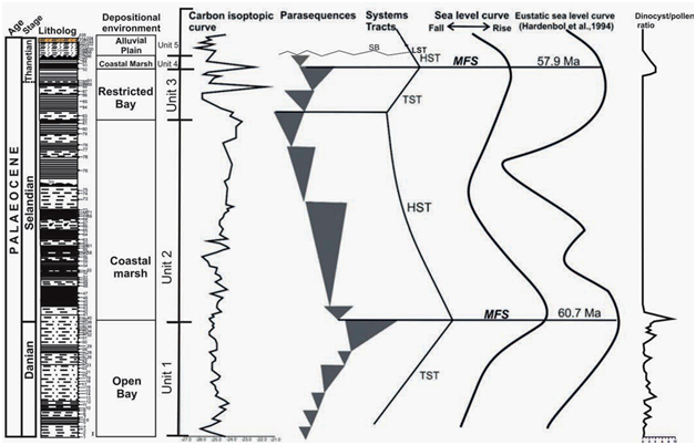
[Figure 3: Giral Lignite succession, depositional environment of Akli Fm.]
Relationships and Distribution
Lower contact
The lower boundary is unconformable with Barmer Fm.
Upper contact
The upper boundary is disconformable with Mata Ji Ka Dungar Fm.
GeoJSON
Fossils
No microfauna.
Age
Depositional setting
Additional Information
Oil and Gas: The Akli Formation contains intervals of lacustrine black shale devoid of reservoir and is interlayered with coaly and silty facies, culminating in the geographically widespread Guda Member coals. Akli coals onlap and cover most of the basin margin faulting in the south, supporting a near-rift depositional setting. (John Dolson, Stuart D. Burley, V.R. Sunder, V. Kothari, Bodapati Naidu, Nicholas P. Whiteley, Paul Farrimond, Andrew Taylor, Nicholas Direen, and B. Ananthakrishnan, 2015 : The Discovery of the Barmer Basin, Rajasthan, India, and its petroleum geology : AAPG Bulletin, 99 (issue 3, 1 Mar 2015), pp. 433-465; https://doi.org/10.1306/10021414045)


